
for Windows 10 and 11
GPS TrackMaker Pro 5.1
Geographic information, made simple
Without the complexity of traditional GIS systems. Capture satellite images, vectorize over raster, calculate areas and export to AutoCAD, QGIS and ArcView.
Everything you need for professional mapping
Five capabilities that set GPS TrackMaker Pro apart from traditional GIS.
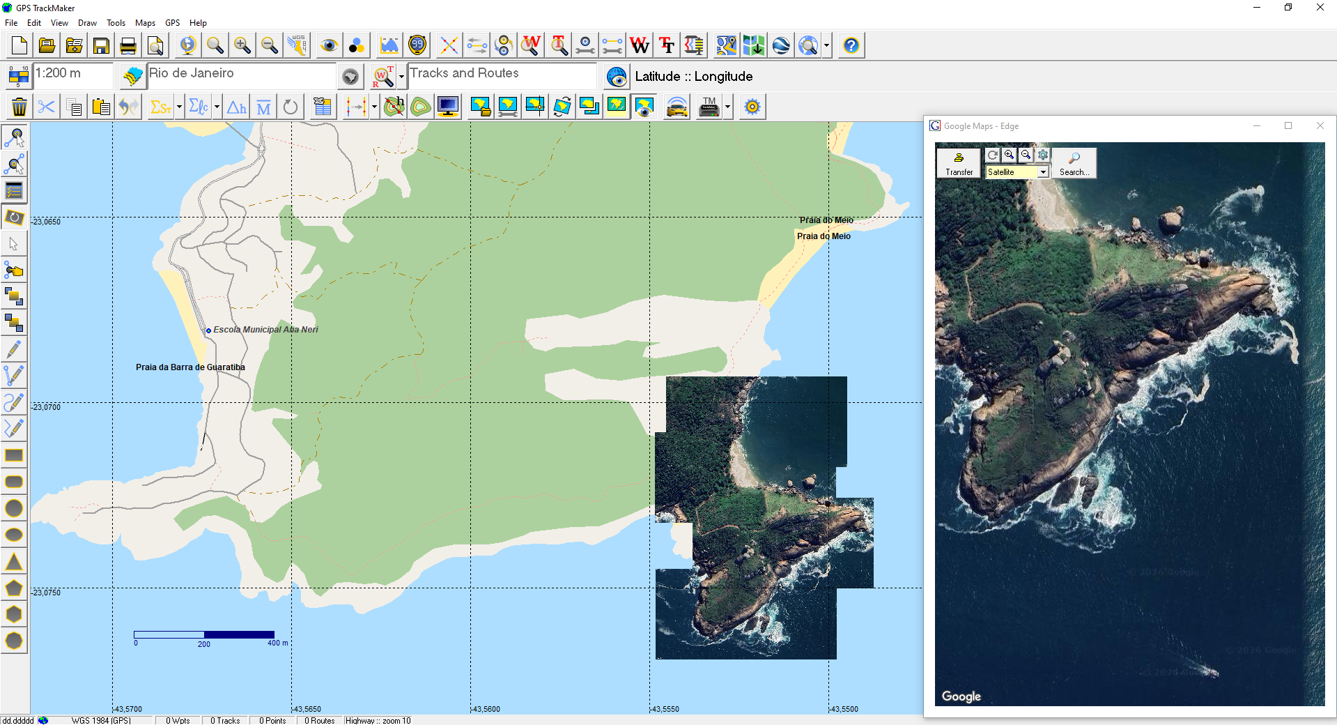
Offline satellite mosaics
Capture satellite images and create perfect georeferenced mosaics for field use, stored in your own files.
OpenStreetMap vector maps
Download millions of editable, royalty-free vector maps of the entire world, directly from our servers.
Learn in minutes
Intuitive interface in the style of a drawing editor. Create high-definition vector maps over satellite images without needing to master advanced GIS concepts.
Export to AutoCAD, ArcView, QGIS
Calculate areas and distances, transfer data to Excel, export to AutoCAD, ArcView, QGIS and other professional applications.
Compatible with Windows 10 and 11
Runs natively on modern Windows environments. Supports multiple coordinate systems with more than 280 datum parameters.
Who is GPS TrackMaker Pro for
Professionals who need to organize geographic data every day.
- Farmers and ranchers
- Agronomists
- Real estate professionals
- Mining professionals
- Surveyors
- Geologists
- Geographers
- GIS and geo-data specialists
Choose your plan
Both plans include all GPS TrackMaker Pro features. The only difference is the number of computers that can run the license at the same time.
1 COMPUTER
US$ 69 / yearFor users who run the software on a single computer.
The plan includes:
2 Computers
US$ 89/ yearUS$ 44.50 per computer for simultaneous use on 2 machines.
The plan includes:
See GPS TrackMaker Pro in action
GPS TrackMaker 5.1 demonstration.
Still not sure?
Try GPS TrackMaker 15.1 Free to explore some of the features. Once you are comfortable with the software, upgrade to the Pro version.